French Pyrenees Weekend - Pic de Carlit Mountain Hike
15km Medium-Hard vertigo inducing circular mountain hiking route via lakes of the lac de Bouillouse French Pyrenees region to the 2921m Pic de Carlit summit
Updated: Nov 21, 2024by: Barcelona Travel HacksViews: 625
About Lac des Bouillouses to Pic de Carlit hiking
The French Pyrenees, three hours by car inland from Barcelona, has some spectacular hiking routes and this challenging route makes a great weekend getaway for people who want a physical challenge.
On two occasions I have hiked to the summit of Pic de Carlit, at 2921 metres above sea level; it was the most physically demanding but most rewarding hike I have ever done. Of the Eastern Pyrenees mountains, Pic de Carlit is the highest peak of the range.
The 15 kilometre route starts at 2017 metres above sea level at the Les Bones Hores hotel/hostel next to the 1.49 square kilometre Lac des Bouillouses dammed hydro-electric reservoir. Around the hotel and lake are horses feeding of the grass and wild mountain flowers.
Next to the hotel the trail takes a rocky path ascending through a forest to arrive at the first natural lake called Estany del Viver. This 10 metre deep lake has a rocky beach which was tempting to swim in but there are a total of 12 lakes in this mountain range and this one had a lot of algae floating near the edge which made it less appealing.
From Estany del Viver the trail gradually ascends parallel to a mountain river before reaching a flat section of marshland which is crossed via a series of wooden footbridges and continues upwards following the river to the second lake, Estany de les Dugues and a little further along the trail it dips down into the river valley which can be crossed by a wooden footbridge.
From here the trail gets a little steeper as it ascends up a glacial valley and passes between the lakes Estany Castellar and Estany De Gombau where there is another wooden footbridge to cross the river.
The trail skirts around Estany de Trebens. Looking ahead into the distance you can see the trail snaking up into the high jagged mountain peeks. the trail is visible by the hikers dotted along the route. Passing Estany de Sobirans, the 6th lake, the trail begins to get a little steeper.
At this point the trail takes a hard rocky ascending path climbing up in the V of two summits to reach a tiny lake (about 50 to 100 square metres) called Estany Gelat. It is here that, even in August, there was patched of snow and huge block of ice next to the river. The snow was not covering the path nor did I need crampons at any point along this route in August but if doing the route in winter or spring then crampons would most definitely be needed.
After Estany Gelat the final push is via a very rocky path that in some parts need to be traversed on all fours, almost climbing rather than hiking. This effort was worth it to reach the summit of Carlit. A metal cross and plaque marks the 2921 metre peak and the 360 degree panoramic views down on the lakes are breath-taking.
The return route firstly is via the same ascending trail. In the way down when approaching Estany Gelat I noticed that there was a natural 5 metre snow slide from the side of the path down to the edge of the lake so I rode my rucksack down. Estany Gelat is an apt name because this lake is shaded by mountains on all sides from the sun so it probably remains frozen and snow covered all year round.
Descending this rocky section of the path, I noticed that the river, whilst flowing, had Icicles hanging off the rocks that it passed over. It is when this steep descent starts to level out along a grassy section of the trail next to Estany de Sobirans where we took an alternative route to the one we ascended via. We took the right fork in the path which took us via more lakes.
The trail follows another valley that has shallow sides of grassy plains with rock outcrops and after a few kilometres the next lake, Estany de Vallell comes into view. Here the path crosses a wide shallow section of a mountain river and continues descending.
Th trail continues descending between the lakes of Estany Sec and Estany de la Comassa. I recommend this lake to swim in or at least dunk the feet. By now they are throbbing from the hike and the cold glacial water was very refreshing. The purple blooming heather and green grassy patches that frame each lake make them the prettiest of the Pyrenees and Estany de la Comassa is particularly beautiful.
From Estany de la Comassa the path descends and joins up with the original path that we took to ascend, passing Estany Negre. Upon arriving at Les Bones Hores hotel and restaurant we enjoyed a cold beer on the patio terrace overlooking the mountain meadow.
Image Gallery for Lac des Bouillouses to Pic de Carlit hiking
Click on any of the 60 images to open full screen gallery player
❮❯
Visiting Lac des Bouillouses to Pic de Carlit hiking
This route is very physically challenging with the middle section being a steep ascent up a rocky mountain path. The top section to reach the summit is also very challenging with some sections of the route involving almost climbing using the rocks as hand holds to climb over large boulders to reach the summit. For people with vertigo this route will be hard.
The starting point of Lac des Bouillouses is only reachable by a €7 shuttle bus service because the road is closed from 7am to 7pm to prevent traffic congestion during the Summer. Parking is provided at Pla de Barrès (départ navettes) where you will find public toilets and the bus stop
I recommend travelling up on a Friday evening and staying in the Les Bones Hores lake side hotel. After 7pm it is possible to drive up and park next to Lac des Bouillouses. I recommend starting the hike up to Carlit Summit early at 9am.
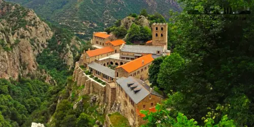
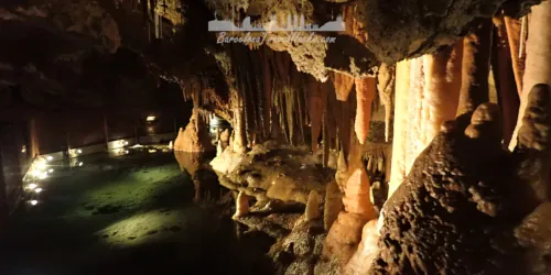
On Sunday you can either wander around the Lac des Bouillouses and Estanys dels Esquits or visit the Grotte Fontrabiouse caves.
Pic de Carlit Mountain Hiking with a dog
This route is great with a dog and does not present any difficulties except for the final push to the summit which does involve clambering over some boulders and you may need to assist your dog here. I have made it to the summit with a dog and she loved it. No need to carry extra water for the dog because there is drinking water readuilly available in the streams and lakes. Be aware that there may be patches of snow, even in summer in the higher parts of the route.
The lower part of the route around the lakes does involve walking through some pine forests so be vigilant in spring and summer for poisonous Pine Processionary Caterpillars.
What to take with you for Lac des Bouillouses to Pic de Carlit hiking
I take a small 30L hiking rucksack and carry three litres of water to do this route. Ensure to use sun cream because you will get burnt otherwise. A hat is also advisable to keep the sun off your neck. comfortable and sturdy hiking boots or shoes are a must.
Lac des Bouillouses to Pic de Carlit hiking Summary of Prices
Train/Bus FareEntry TicketAdditional InformationTrain/Bus FareEntry TicketAdditional InformationAdult€ 0.00€ 0.0065€ based on 4 people sharing a room for 2 nightsChild€ 0.00€ 0.00Group/Family Ticket?65€ based on 4 people sharing an apartment for two nightsNotesShuttle bus €7 per person. toll Tunel de Cadí (€13.93 for a car)
Getting to Lac des Bouillouses to Pic de Carlit hiking
Address: Lac des Bouillouses, Mont-Louis, France. 66210
Leave Barcelona via the C58 motorway passing Sabadell and Terrasa and transition onto the C16 passing Berga. Take the toll Tunnel de Cadí (€13.93 for a car) and after passing the toll booths at the northern end there is a service station Àrea de Servei Túnel del Cadí - Porta Cerdanya. immediately after the service station is junction onto the C162 towards Puigcerdà.
At Puigcerdà cross the border into France taking the N116 to Mont-Louis. At Mont-Louis roundabout, take the D118 followed by the D60 to Pla de Barrès (départ navettes) parking.
Wikiloc Trail for Lac des Bouillouses to Pic de Carlit hiking
a0346 - Llac de les Bulloses to Pic Carlit
14km Medium-Hard vertigo inducing circular mountain hiking routevia lakes of the lac de Bouillouse french Pyrenees region to the 2921m Pic de Carlit summit