 CAR
CARBerguedà region of the Catalonian Spanish Pyrenees
The Berguedà pre-Pyrenees plains & Pyrenees mountains are accessible by car for great summer and winter hiking trails from the many pituresque villages
Description of Pyrenees Berguedà Region
El Berguedà is a county located in the province of Barcelona forming the Central Catalan Pyrenees and pre-Pyrenees. Berguedà is not served by a train line but has extensive bus routes that serve the larger towns using the C16 motorway which is the primary route via the Tunel de Cadí to get to the Principality of Andorra from Barcelona.
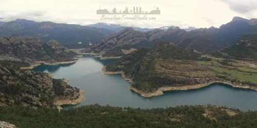
El Berguedà contains the notable villages of Castellar de n'Hug, Pobla de Lillet, Sant Jaume de Frontanyà, Guardiola de Berguedà and Gósol famed for great mountain hiking teritory and beutiful stone buillt houses. The rivers in these villages and the suraounding mounain water baisins form the starting points of one of Barcelona's main Rivers, The River Llobregat.
Berga is the capital of the of Berguedà county having a population of sixteen thousand inhabitants. The origins of the name Berga come from the Iberian Bergistani tribe which lived in the area before the Roman conquest when the town was known as Castrum Bergium. The Bergistani tribe were first subdued by Hannibal in 218 BC and rebelled twice against the Romans. After the second Bergistani uprising the Romans sold most of the tribe into slavery.
Berga fell under Arabic rule in 715 BC before the expolsion of the Moors from Spain by the Christians. Berga was ruled by viscounts in the Early Middle Ages and had its own counts from 988. Count Wifredo II de Cerdaña ruled until his retirement to Canigó Monastery. When the count Bernardo Guillermo died without an heir, Berga passed to the counts of Barcelona in 1117 being ruled by count Ramón Berenguer III. The black plague arrived in berga in 1347.
The medieval centre of Berga was constructed around 1360. Between 1654 and 1655 the town was captured by rench forces during Spanish War of Sucession and in 1854 there was an outbreak of Cholera. The population of Berga has been in decline since the 1960s with the gradual closure or mechanisation of the principal industries of mining, textile, forestry, livestock and agriculture. The county of Berguedà today has a vibrant tourism sector with many rural hotels and restaurants.
The climate of Berguedà is warm and sunny in the summer, with some rainy and cold days in the winter experiencing an average yearly rainfall of 1000mm. Snow can be found in the highest peeks in winter. The vegetation of the mountain lower slopes is made up of red pine and oak forests with beach forests in shady places. Fir trees can also be found. above 1700 metres (ASL) black fir can be found and above 2200 metres alpine vegetation. holm oaks inhabit the driest places with poor soils, with oak forests where it rains more and the soil is deeper. In the central and western part the Valencian oak usually dominates, and in the most eastern and northern part the Martinese oak. The Oaks can be found in areas with black and red pines.
Temperatures in Winter can go below zero degrees celcius, especially in the mountains and in summer around 25 degrees celcius with the anual average being between 11 and 13 degrees celcius.
Hike to the top of Pedraforca's Gallina Pelada at 2400 metres above sea level from the Font Freda. 6h hike to ones of most visited mountains in the Pyrenees.
- Includes:
- Guided hiking/walking tour with a registered mountain guide
- transport from your hotel in Barcelona in a people carrier
- Visit the Romanesque and middle-age villages, nearby the mountain
- Hike at your level from beguiners to experts
- Snack
- Accident insurance
Powered by GetYourGuide
Attractions in Pyrenees Berguedà Region
CAR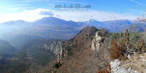 CAR
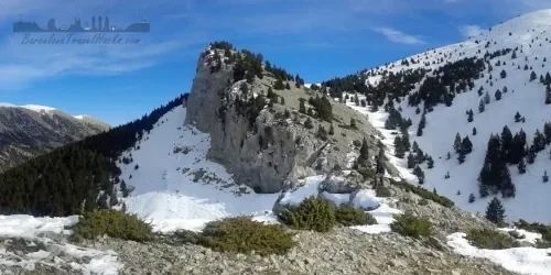
CARCingles de Malanyeu Autumn and Winter 14 km hiking route
Circular route via enchanting beach & oak forests to a ridgeline path with views of the high Pyrenees including Pedraforca plus secret waterfall desent path
Read more >
 CAR
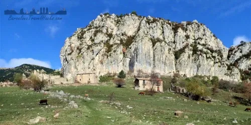
CARPeguera Abandoned Lignite Coal Mine Village Hiking
14km circular hiking route from abandoned village of Peguera to Roca Blanca & Gallina Pelada summits plus Museu de les Mines de Cercs
Read more >
 CAR
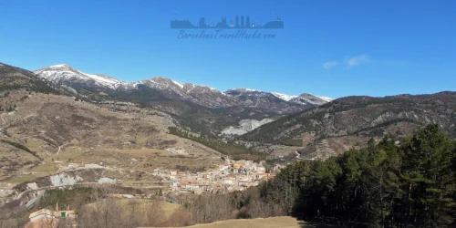
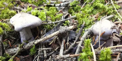
CARCatllaràs Forest Winter Hiking in Secret Gaudí Town
La Pobla de Lillet contains two secret Gaudí works, a cement museum & tourist train as well as a great forest for mushroom picking, hiking & snow shoe
Read more >
 TRAIN+BUS
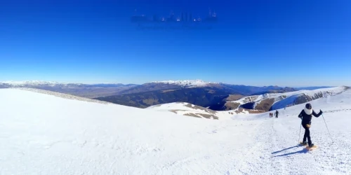
Easy Snowshoe hike la Molina Cable Car Station Niu de l'Aliga
Getting to La Molina Ski Resort by public transport, information about the activities and services, Snow shoe activity for beginners
Read more >
 CAR
CARPedraforca Circular Mountain Hiking Route from Gósol Village
Second most famous mountain in Catalunya. Pyrenees twin peaked summit medium circular 14km hiking route for summer or winter
Read more >
 CAR
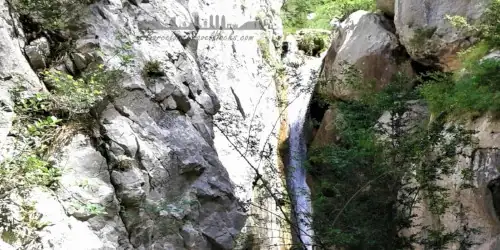
CARParc Natural del Cadí-Moixeró waterfalls
Medium-Hard 15km Cadí-Moixeró natural park circular route via Bullidor de la Llet & Els Empedrats waterfalls, Sant jordi Hostel & Boixasa summit
Read more >
 TRAIN
TRAIN